
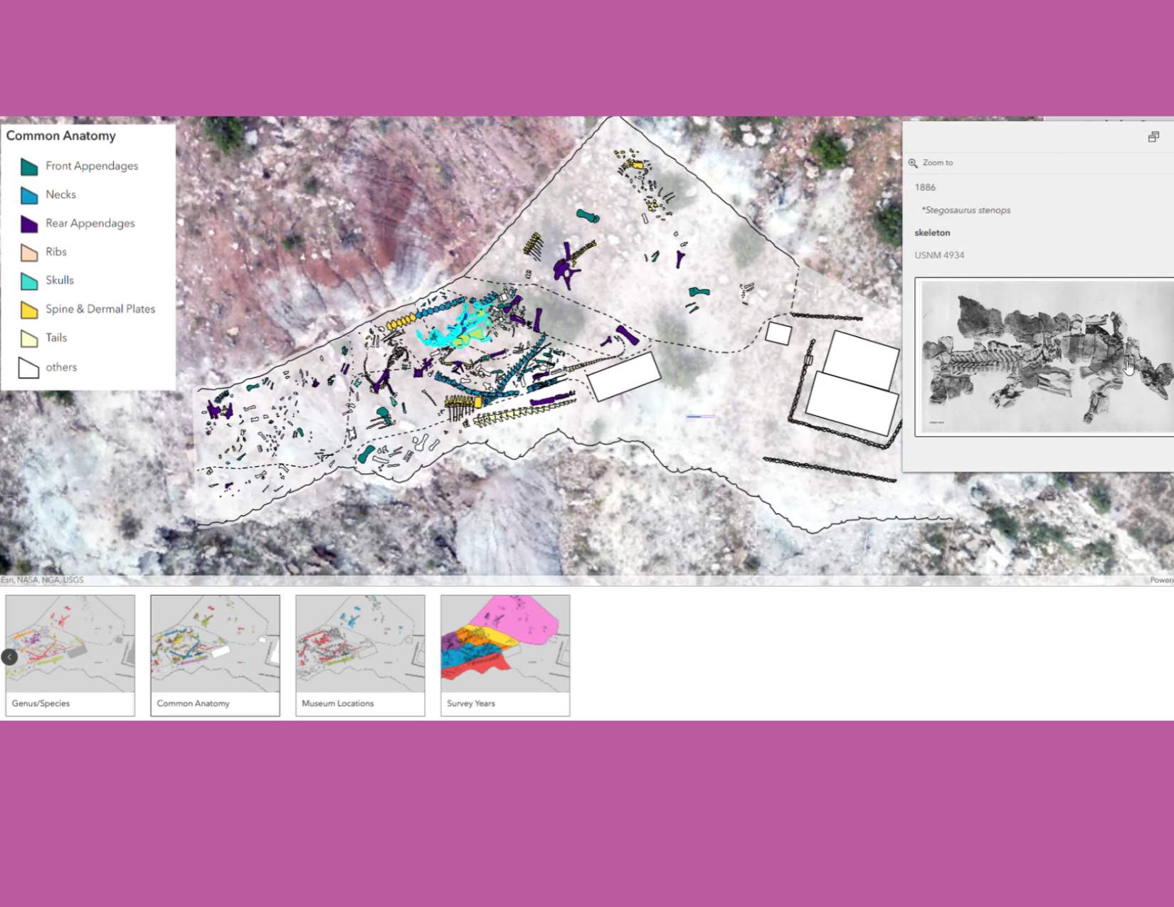
STATE and LOCAL GOVERNMENT

Supporting communities with practical GIS.
Rapidly changing technology. Limited staffing. New legislative requirements.
We help governmental organizations manage challenges and constraints. Our GIS consulting work supports:
City and County Government
Public Works
Water Utilities
Land Records Management/Assessor’s Office
Addressing
Emergency Services
Public Safety
and more….
State Government
Transportation
Vision Zero Initiatives
Zoning
Infrastructure Investment and Project Prioritization
Environmental Health and Conservation
Parks and Recreation
and more….

Argis Solutions’ GIS services cover the spectrum of GIS needs, from architecture to complex development.
We are experts in Esri technology, and we’ll help your organization maximize its ArcGIS® investment.
GIS CONSULTING SERVICES
FOR STATE AND LOCAL GOVERNMENT

A GIS Assessment offers comprehensive understanding of your current state and outlines a detailed roadmap to a right-sized future state. A GIS System Health Check provides a quick snapshot of your current GIS system that highlights potential issues with security, versioning, and more.


The interplay between third-party software, older tools and applications, and your ArcGIS system upgrades can be complicated. We can help you move towards modernization and a system that is up-to-date, secure, and functional.
Attracted to the scalability and affordability of the cloud? You are not alone! We can architect and implement your transition to AWS and Azure cloud platforms or ArcGIS® Online .

From custom configuration and third-party integration for ArcGIS® Solutions to custom applications and widgets, geoprocessing services, customized Survey 123 surveys....and more.

Have a project that requires more hours than your team can absorb? Our ad hoc staffing services can help you reach the finish line.
We also offer tool maintenance services. Receive a quarterly compatibility report, development updates for tool compatibility, and a tool refactoring plan if deprecation is present.


Additonal GIS Consulting Services
GIS Jumpstarts

GIS Administration for ArcGIS Online
Enterprise GIS Administration
GIS Backup and Recovery Solutions
Data Modeling and Data Governance
…and more
STATE AND LOCAL GOVERNMENT SUCCESS


Why Argis?
We are award-winning Esri Gold Partners with three Esri specialties, including the State and Local Government Specialty. Our combined 80+ years of GIS experience results in practical, budget-minded, tailored solutions for each organization we serve.