Better Road Analysis with Machine Learning and Image Recognition
by Raj Shah and Steve Loo
The City of Houston, Texas is now actively identifying which roads to repair using a combination of ArcGIS® software, machine learning, and image recognition.
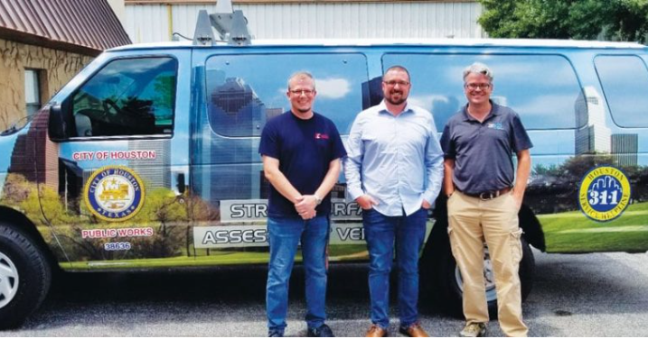
The City of Houston contains approximately 15,000 lane miles that are heavily used and need regular repairs. In the past, the City relied on an Street Surface Assessment Vehicle (SSAV) to inspect and provide data for recommended maintenance for this immense quantity of roadways. The data gathered by the SSAV resulted in a large amount of GIS data that required a system able to quantify and interpret that huge amount of data. While the system already in place was somewhat effective, in 2015 the City decided to re-purpose a single SSAV vehicle into what would be called a Ride-Quality Measurement Vehicle (RQMV). This updated vehicle would add advanced capability to its road monitoring and maintenance programs.
The City of Houston selected Indigo Beam to (who sub-contracted to Argis Solutions, Inc. and International Cybernetics) implement a machine learning and image recognition project utilizing this re-purposed RQMV. During this project, the newly created team provided both physical and technological upgrades to the RQMV van, enabling the City, with minimal investment, to update what had become a technologically outdated asset.
The project began with the Street Surface Assessment vans driving the city and rating the roadways using the International Roughness Index (IRI) scores and Pavement Condition Index (PCI) scores while capturing video of the streets for the entire City of Houston. Once the SSAV data gathering was completed, the newly upgraded Ride-Quality Measurement Vehicle (RQMV) was sent out to record and rate project work sites and problem areas both before and after road work and maintenance repair had been completed. By adding the RQMV assessment and combining the rating work between the larger SSAV runs and updated RQMV data into their workflow, the City generated a wealth of robust ArcGIS data.
As a central part of the project, the Argis team designed and built a sophisticated migration tool to pull the data collected and move it to the City’s data servers. This carefully crafted migration tool pulls files, interprets those files, allows selection of critical information from those files and compiles that data appropriately and as needed into the City’s database. With a system in place to monitor and track this of data, the City should be able to improve current workflows, assist with determining the priority of roadwork based on network or council district.
The application of machine learning combined with image analysis and recognition to a Public Works management system (SSAV/StreetSaver systems) will assist with creating valuable outcomes for the City. This advanced system continues to be fed thousands of images and videos, allowing operators to make quality decisions regarding their roadways. Whether gathered in meeting conference rooms or from individual offices, Houston Public Works management can immediately know the ride-quality condition of a lane that was driven in the wheel path for any given road, the possible maintenance requirements of that road and hold contractors responsible for the work they provide.
Neighborhood pavement analysis was an additional deliverable from the project. The City now has an additional tool to analyze and rate neighborhood pavements. The advanced analysis also allows the City to have an additional tool to assist with spreading out maintenance where most needed city-wide across Council Districts.
The City of Houston’s data gathering process remains active and ongoing. The more data the system is given, the more accurately the system continues to predict when the roads will need repairs. With the help of the Argis team, the City continues to make practical sense of its GIS roadway pavement data. Argis Solutions and project partners Indigo Beam and International Cybernetics were excited to be the co-creators of this first-of-its-kind project and for the efficiencies it provided to the City of Houston Public Works.