Silver Lake Construction Uses ARCAD App to Improve Accuracy in Foundation Construction
Argis Solutions’ recent work with Silver Lake Construction Company is highlighted in depth by Chris Andrews on Esri’s ArcGIS Blog. Andrews recognizes the value augmented reality (AR) adds to GIS data, noting:
“As a product manager driving 3D, BIM, and other related software efforts at Esri, I’m always looking for applications of geospatial technology that can improve the lives of real users. We get asked about AR a ton and whether through partner apps, such as Argis Solutions, or through development using our ArcGIS Runtime SDKs, it’s great to be able to report that real partners and customers are building AR applications that are transforming the experience of GIS in the field. I expect to see much more like this in the future.”
Silver Lake Construction Company builds residential foundations in the Las Vegas, NV area. First on the construction site, Silver Lake must be accurate and efficient. Brett Willis, Silver Lake’s president, was researching avenues for increasing his company’s accuracy in construction. His question: Did a tool exist that could help his crew dig foundation cuts on bare-earth plots with better than two-inch accuracy?
Augmented Reality: A Tool for Accuracy
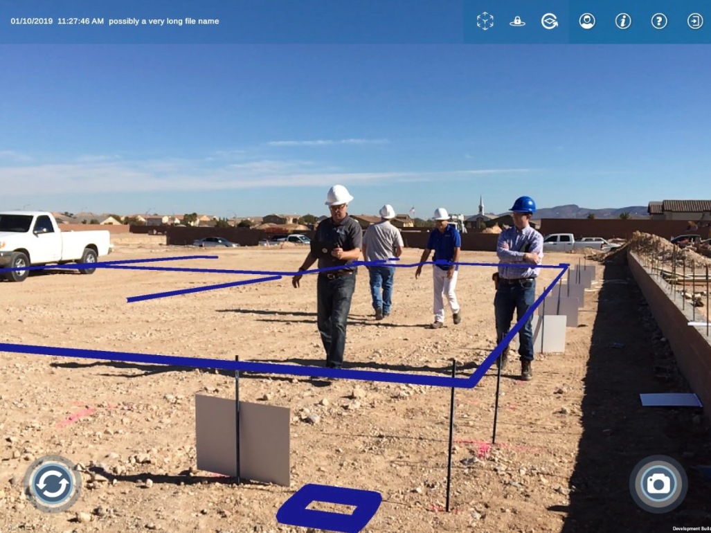
The answer to Willis’ question was found in augmented reality technology. The Argis Lens, a geospatial AR app created by Argis Solutions, projects ArcGIS data into the real world using a mobile device. For this particular problem, the Lens was modified to help Willis meet his goal of two-inch accuracy for foundation construction. Typically, the Lens uses onboard GPS within the mobile device or paired GPS units to achieve the required accuracy, but Silver Lake’s accuracy needs were more exacting.
Up to the challenge, the team at Argis created a new application, ARCAD, which uses computer vision technology. Computer vision enables a computer to see something and make a decision that a human no longer has to make. Photos of fruit affixed to stakes were used to mark known locations on the construction site. Through computer vision, ARCAD was able to recognize these complex images, anchor the precise geospatial location, and project the building plan onto the ground. While still in the field-testing stage, ARCAD is meeting the 2-inch accuracy requirements.
Overall, the Silver Lake crew is cautiously optimistic about ARCAD’s ability to streamline their work process while allowing them to achieve the high level of accuracy needed for foundation construction. Looking to the future, Silver Lake sees many additional possibilities for further ARCAD app development.